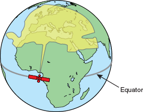
Communications satellites are located in fixed positions above the Earth’s equator and relay data to/from the earth within the regions that they serve. Therefore, to communicate via a given satellite, you must be located within that satellite’s unique coverage area, also known as its “footprint.”
To view the latest mini-VSAT Broadband satellite coverage map, visit KVH’s website at www.kvh.com/minivsatmap [Internet access required - airtime charges may apply]. The map is an amalgamation of all of the individual satellites’ coverage areas.
Example of a Satellite Footprint

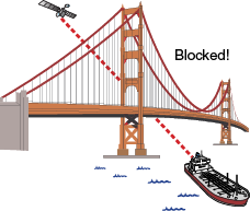
In addition, since satellites are located 22,300 miles (35,900 km) above the equator, the TracPhone antenna must have a clear view of the sky to transmit and receive signals. Anything that stands between the antenna and the satellite can block signals, resulting in lost data. Common causes of blockage include the following:
Trees, buildings, and bridges
Other vessels docked alongside your vessel
Onboard masts, antennas, or other structures
Inclement weather conditions
Example of Satellite Blockage
